| The County Parcel Map Parcel Map Components |
|---|
 |
| The County Parcel Map Parcel Map Components |
|---|
|
This map may be used for many purposes, to include:
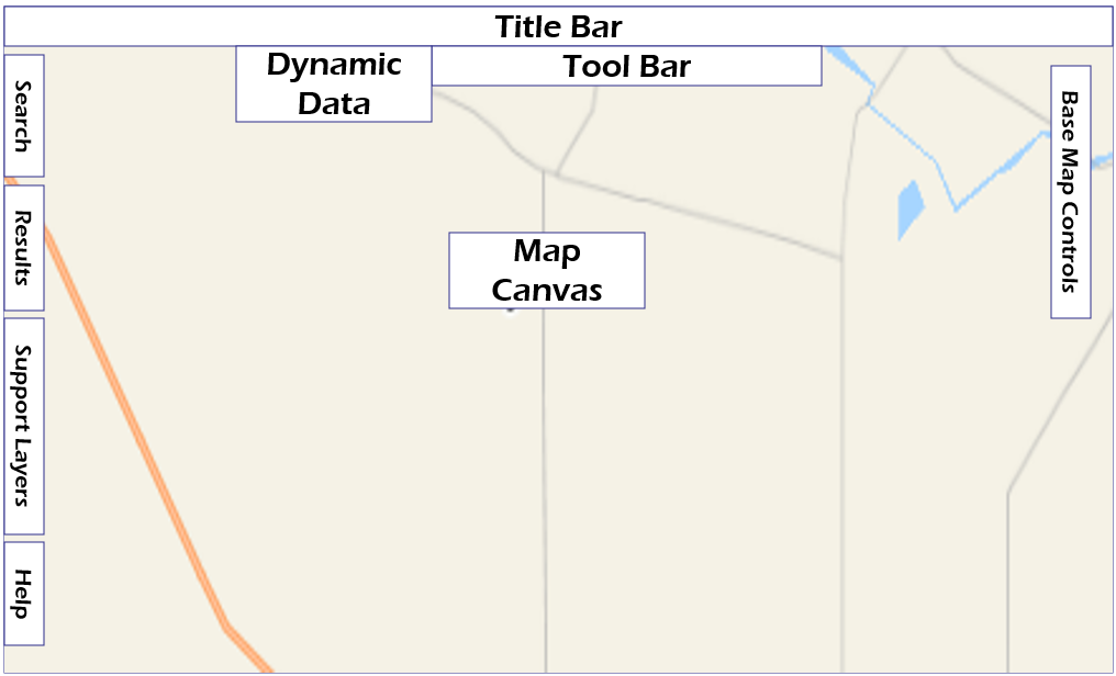
Key map control groups include:
| Tool Groups | Tool Group Icons | |
|---|---|---|
| Title Bar |  |
The Title Bar lists the map title, together with links to other information sources. |
| Base Map Tools | 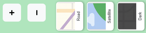 |
These controls zoom and pan the map to desired locations, while also turning different base map layers on and off. |
| Dynamic Data | 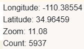 |
The current user-point/cursor location in geodetic latitude and longitude. A relative zoom level is also included. Measured distances also appear here. |
| Tool Bar | 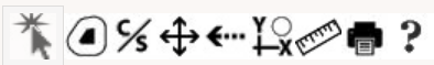 |
These tools provide functions to measure, print, and manage your property selection. |
| Search Tab |  |
This tab opens the map legend and associated controls. |
| Results Tab |  |
The tab opens results, a listing of currently selected parcels. |
| Support Layers Tab |  |
The tab opens a list of all geographic support layers and their controls. |
| Help Tab |  |
The tab opens the map help library |
| Mouse Button Controls | Mouse controls used to zoom and pan the map. | |
| AutoDesk TrueView | In many cases, the County provides information in the form of electronic drawings stored in AutoDesk format. This link may be used to download AutoDesk viewers. | |
| Avery 5160 Format | This mapping tool employs Avery 5160 format when exporting to mailing labels. |